
Montney Regional Shale Study
Analysis of 60 key wells in the Montney and Doig Formations
The Lower to Middle Triassic Montney and Doig intervals represent extremely prolific resource plays.
This study provides insight into the connectivity of textural attributes of the wells.
The study wells represent a portion of our experience in this area. View our Interactive Map to see just how many wells we have analyzed.
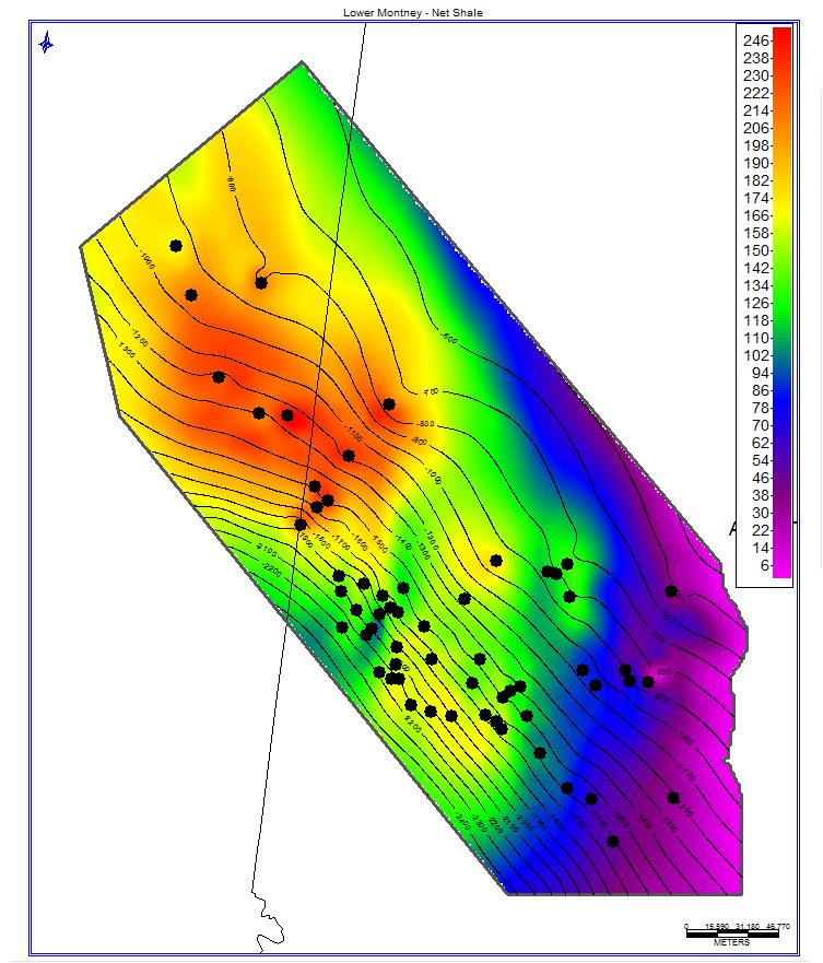
This study provides a petrophysical and geologic analysis of key wells in the Montney and Doig Formations. NUTECH provides insight into the connectivity of textural attributes of the wells with NULOOK Shale Analysis and NUVIEW 2D Attribute Mapping.
The Montney Formation is a Lower Triassic age unconventional reservoir located in the Western Canadian Sedimentary Basin of British Columbia and Alberta, Canada. The formation is composed of siltstone, shale, dolomitic siltstone, and fine grained sandstone. The Montney Formation is unconformably overlain by Jurassic or Cretaceous deposits, and unconformably underlain by the Permian or Carboniferous strata. The Montney Formation reaches a maximum thickness of 920 feet (280 meters), and is estimated to have reserves on the order of 449 TCFG, 14.5 BBNGL, and 1.1 BBO. Horizontal drilling and extensive fracturing is necessary to have hydrocarbons flow through the low permeability siltstone. The Doing Formation is a Middle Triassic age unconventional reservoir located in the Western Canadian Sedimentary Basin of British Columbia and Alberta, Canada.
The Doig Formation is composed of argillaceous siltstone and calcareous phosphatic shale. The Doig, which reaches a maximum thickness of 620 feet (190 meters), conformably overlays the Montney Formation, which is directly under the phosphatic nodular beds of the Doig.
purchase the full study or request your own
deliverables
Reservoir potential evaluation
NULOOK® Shale Analysis
- 60 wells
NUVIEW® 2D Attribute Mapping
- Formation Parameters
- Petrophysical Parameters
- Fluid Parameters
- Cross Sections
- Geochemical Parameters